The ISRO's National Remote Sensing Center (NRSC) in Hyderabad has released high-resolution satellite images of the landslide-affected area of Wayanad which show widespread damage. The NRSC has released before and after photographs of the July 30 landslide of Chooralmala in Wayanad district. The photos show that the landslide displaced about 86,000 square meters of land.
One image was taken by the Cartosat 3 satellite on May 22 and the RISAT satellite took another picture, a day after the landslide on July 31.
A very high-resolution RISAT SAR images from July 31 show the same massive flow of debris from the crown to the end of the run-out zone. The estimated length of the landslide flow is 8 km.
Photographs released by the NRSC also show evidence of previous landslides at the same location, suggesting that the Crown Zone is the reactivation of an earlier landslide. The size of the main scrap of the landslide is 86,000 square meters. The debris flow widened the course of the Iruvinpuzha and Mundakkai rivers, breaching their banks and destroying villages and houses along the banks. ISRO has made a detailed WT of Ground Zero while explaining these pictures.
40 teams of rescuers resume search operations
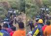
40 teams of rescuers resumed search operations in landslide-hit Wayanad district on the fourth day on Friday. The search and rescue operations that got underway early morning received an impetus due to the completion of the 190-foot-long Bailey bridge that will enable the movement of heavy machinery, including excavators, and ambulances to the worst-affected Mundakkai and Chooralmala hamlets, they said. The 40 teams will conduct search operations in six zones of the landslides-hit areas -- Attamala and Aaranmala (first), Mundakkai (second), Punchirimattam (third), Vellarimala village (fourth), GVHSS Vellarimala (fifth), and riverbank (sixth). According to official sources, the extent of human loss will emerge when rescuers clear houses covered by debris and wood logs using heavy machinery. So far, 308 people have been killed and over 200 missing in the tragedy.