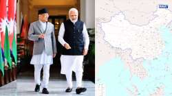
Nepal reacts sharply to China's new map that include Kalapani, Lipulekh and Limpiyadhura in India
The India-Nepal bilateral ties came under strain after Defence Minister Rajnath Singh inaugurated an 80-km-long strategically crucial road connecting the Lipulekh pass with Dharchula in Uttarakhand in May 2020.

Nepal on Friday lodged a strong protest over China's recent so-called "standard" map that did not include the Lipulekh, Kalapani and Limpiyadhura areas as parts of the Nepali territory and included in the Indian territory. Notably, the regions have been disputed for decades. India calls these regions as theirs while the neighbouring country Nepal calls these areas as theirs.
"Nepal stands firm and clear on its political and administrative map unanimously approved by the Parliament of Nepal in 2020," the spokesperson for the Chinese foreign ministry issued a clarification amid growing calls from different sections to take up the matter with China.
He said that the government of Nepal unequivocally believes that this map must be respected by our neighbours as well as the international community.
ControversyThe issue remained under control until India published a revised political map showing the newly created Union Territories of Jammu and Kashmir and Ladakh in 2019. At that time, India showed Kalapani as part of the Pithoragarh district. This prompted Nepal to exhibit strong protests against New Delhi.
Later, in 2020, Nepal published a new map incorporating the regions as part of Kathmandu. The map was unanimously approved by the federal parliament in 2020. India too lodged a strong protest at that time, resulting in soaring tension between the two neighbouring nations.
The India-Nepal bilateral ties came under strain after Defence Minister Rajnath Singh inaugurated an 80-km-long strategically crucial road connecting the Lipulekh pass with Dharchula in Uttarakhand in May 2020. Nepal reacted sharply to the inauguration of the road claiming that it passed through Nepalese territory. India rejected the claim asserting that the road lies completely within its territory. India has sternly asked Nepal not to resort to any "artificial enlargement" of territorial claims.
Nepal's Parliament unanimously passes bill to redraw map incorporating 3 Indian areas
Nepalese PM to discuss the issue in BeijingThe latest controversy came as Nepali Prime Minister Pushpa Kamal Dahal was about to leave for China today.
Agni Prasad Sapkota, a vice-chairman of the CPN (Maoist Centre), told the Kathmandu Post that the Prime Minister will raise the issue when he meets Chinese President Xi Jinping in Beijing.
“China not incorporating the genuine map of Nepal will figure during the prime minister’s visit.” “This is an important issue. Why there was a lapse and how the new map of Nepal was not incorporated should be taken up diplomatically. We learned that the previous government had communicated with China after issuing the map,” Sapkota said.
China showcased some Indian regions in its new mapEarlier this week, China again enraged New Delhi by incorporating India's integral regions such as Arunachal Pradesh, and Aksai Chin in their latest edition of the map released on Monday. The so-called standard map released on the website and social media platforms of the state news publication, Global Times, included the disputed areas including Arunachal Pradesh, Aksai Chin region, Taiwan and the disputed South China Sea under their territory.
"The 2023 edition of China's standard map was officially released on Monday and launched on the website of the standard map service hosted by the Ministry of Natural Resources," read the post. "This map is compiled based on the drawing method of national boundaries of China and various countries in the world," it added.
It is worth mentioning China claims Arunachal Pradesh is a part of the Tibet region.
China refuses to budgeChina's foreign ministry suggested that it would not budge on the issue of the new map.
"China’s position on the South China Sea is consistent and clear. The competent authorities of China routinely publish standard maps of various types every year, which aims to make standard maps available to all sectors of society and raise public awareness of the standardised use of maps. We hope parties concerned can view it in an objective and rational light," Foreign Ministry Spokesperson Wang Wenbin said in response to a question on Thursday when sought his comment on the protests from countries like India, Malaysia as well as the Philippines against this new Chinese map.
Also Read: China's new 'standard map' draws flak as neighbours issue strong statements like India

