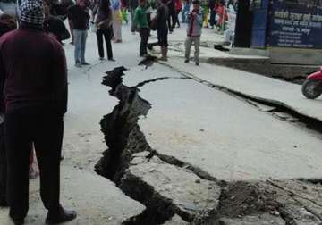
Kathmandu: Saturday's earthquake in Nepal that has left thousands dead and affected millions, shifted the earth beneath Kathmandu by up to several metres south. The quake that was measured 7.9 on Richter scale, however, has not affected the height of Mount Everest.
According to James Jackson, University of Cambridge tectonics expert, the ground beneath the capital Kathmandu may have moved about three metres (10 feet) southward.
Jackson used seismological data obtained from sound waves to make this observation. Sound waves travel through earth after an earthquake,
Head of the physical sciences department at the University of Adelaide, Sandy Steacy, has made similar analysis.
"It's likely that the earthquake occurred on the Himalayan Thrust fault, a plate boundary that separates the northern moving Indian sub-continent from Eurasia," said Steacy.
She added, "The fault dips about 10 degrees to the north-northeast. The relative movement across the fault zone was on the order of three metres at its greatest, just north of Kathmandu."
The shift was caused by two tectonic plates, one carrying India pushes another bearing Europe and Asia at a rate of about two centimetres (0.8 inches) per year. Scientists believe that this was the process which created Himalayas.
However, the height of the world's highest peak Mount Everest has not changed more than a few millimetres, say the experts. The reason, scientists say, is because the mountain was not directly above the fault plane.
The avalanche, resulted from the earthquake may have dislodged some of the snow cover on the summit.
The massive 7.9-magnitude quake on Saturday was the Himalayan nation's deadliest disaster in more than 80 years. The disaster has killed more than 4,300 people and the number is still rising.
Latest World News
