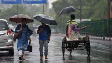
The monsoon embraced Delhi in an impressive manner on June 30 but rains have repeatedly given the capital a miss since then, with the India Meteorological Department (IMD) struggling to make accurate predictions.
Though experts acknowledged that providing accurate localised forecasts is a complex process, they said the central weather forecasting agency cannot be off the mark repeatedly.
The Safdarjung Observatory, Delhi's primary weather station, has recorded just 2.6 mm of rainfall in the last 10 days.
It has gauged 144.3 mm of rainfall against a normal of 126.7 mm since June 1, when the monsoon season starts. Of this, 117.2 mm came in just 24 hours ending at 8:30 am on July 1.
After the season's first spell of heavy rain on June 30-July 1, the IMD issued an orange alert, warning of moderate rainfall in the city on July 1. A yellow alert was issued for light rain over the next six days.
While just 2 mm of rainfall occurred in the next three days (July 1-July 3), the Met office on July 4 issued a yellow alert for July 5 and an orange alert for July 6, which was later shifted to July 7.
While Delhi kept waiting for rain, experts attributed the dry spell to the shifting of the monsoon trough towards central India due to the development of a low pressure area over Odisha which subsequently travelled to Gujarat.
"The low pressure area had pulled the trough towards central India, leading to heavy rainfall there," said Mahesh Palawat, vice president (meteorology and climate change), Skymet Weather.
The IMD later predicted "fairly widespread to widespread rainfall activity" over west Uttar Pradesh, Punjab, Haryana, Chandigarh, Delhi and Rajasthan on July 9 and July 10, and issued a yellow alert, warning of moderate rainfall in the capital on Sunday.
But that did not happen either.
"It was expected that the western end of the monsoon trough would again shift towards the north after the low pressure area degenerated. However, the development of a cyclonic circulation over southwest Rajasthan and adjoining parts of south Pakistan in the last 24 hours did not let the monsoon trough come near Delhi and neighbouring areas. It is still stuck south of Delhi and passes through Bikaner and Kota," he said.
Parts of Punjab and Haryana received rainfall due to the convergence of winds -- westerly winds in the upper level and easterly winds in the lower level -- in that region.
There are chances of patchy rainfall or thundershowers as a result of moisture incursion and localised heating on Sunday, Palawat said.
Delhi won't get any rain on Monday and Tuesday. Rain is likely on July 13 and July 14 after the low pressure area crosses Gujarat and the monsoon trough shifts towards the north, the meteorologist said.
Asked about the repeated wayward forecasts by the IMD about rainfall in Delhi, former secretary, Ministry of Earth Sciences, Madhavan Nair Rajeevan said, "Once in a while is okay, but it should not happen often."
"Yellow, red, orange alerts are issued when you are really confident about something which is going to affect people... With the modern technology (available), you have good inputs before you issue alerts. We have improved a lot with time. We should be able to make a good forecast at least two or three days in advance," he said.
He said it could also be a case of overwarning considering Delhi is the national capital and forecasters tend to be cautious. "But it can't be a continuous process. You cannot do it every day. If you do, it means you are missing something."
"I do not want to blame anyone because I do not know the details," Rajeevan said.
He said localised weather forecasts have become complicated because models do not account for pollution, aerosols and land use changes.
Also Read | Telangana rains: Weather office issues red alert for 2 days, flooding likely in some areas | Details
Latest India News
