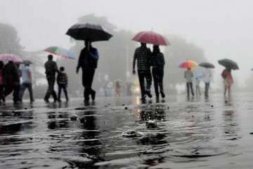
Light rain, coupled with thunderstorm, lashed the national capital and its neighbouring areas on Tuesday. According to the India Meteorological Department, a western disturbance is behind the sudden rain, thunderstorm and increase in wind speed.
The western disturbance is a cyclonic storm that originates in the Mediterranean Sea and travels across Central Asia. When it comes in contact with the Himalayas, it brings rains to the hills and the plains.
However, the respite will not last long. On Tuesday, the city recorded a maximum temperature of 31-degree Celsius, which will rise to 37-degree Celsius by March 28. The last time the city received rain and thunderstorm was on March 12.
The IMD has predicted partly cloudy sky for Wednesday. The temperature will, however, be constant.
The System of Air Quality and Weather Forecasting and Research (SAFAR) said that the rainfall has contributed to the improvement of air quality in the national capital, where the Air Quality Index (AQI) stood in the 'poor' category at 245 microgram per cubic metre.
"Better ventilation and washout are likely to influence AQI positively. AQI is likely to marginally improve to the lower end of the 'moderate' category on Wednesday. Moderate to poor AQI is forecasted for March 25 and March 26," it stated.
Latest India News
