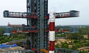
ISRO’s PSLV-C38 on Friday successfully placed India’s ‘eye in the sky’ Cartosat-2E satellite and 30 other satellites in their respective orbits. The successful launch of Cartosat-2E puts the total number of satellites being used for military purposes to 13.
The images sent by these satellites, which can be used for surveillance and mapping border areas, are primarily used for tracking the movement of enemies both on land and sea.
“Most of these remote-sensing satellites are placed in the near-earth orbit. Placing these satellites at the sun-synchronous polar orbit (about 200-1,200 km above the Earth's surface) helps in better scanning of the earth. However, some of these satellites have also been put in the geo orbit,” Times of India quoted a source as saying.
Cartosat-2E, the 712-kg satellite meant for earth observation, can accurately spot objects within a square of 0.6 metre by 0.6 metre.
“The 13 satellites used by the military for surveillance include Cartosat 1 and 2 series and Risat-1 and Risat-2,” said the source.
The Navy also uses Gsat-7 for real-time communication among its warships, submarines, aircraft and land systems. India also has the capability to launch anti-satellite weapon (ASAT), which is meant to destroy enemy satellites. Only the US, Russia, and China are known to have developed these weapons.
Latest India News
