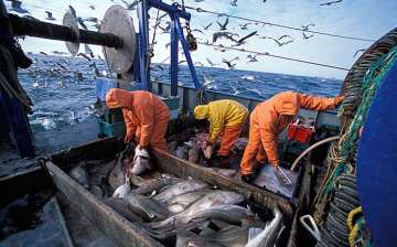
Fishermen on a roll, this app helps them stay in safe waters
Bengaluru: Fifty-year-old K Anjaapuli – who has been fishing for 35 years along the coast of Puducherry – now takes his phone along to know exactly where the fish are, thanks to the Fisher Friend Mobile Application (FFMA) which gives him a wealth of
Bengaluru: Fifty-year-old K Anjaapuli – who has been fishing for 35 years along the coast of Puducherry – now takes his phone along to know exactly where the fish are, thanks to the Fisher Friend Mobile Application (FFMA) which gives him a wealth of information from exact geographic coordinates of shoals of fish, real-time data on wave length and wind speed.
"After the tsunami of 2004, we got only 1/10th of the harvest we would get earlier. The movement of fish turned unpredictable," said Anjaapuli.
In addition to information on movement of fishing shoals, which is updated once every 24 hours, the app also lets you identify danger zones like coral reefs and sunken ship wreckages. Other details like wind speed and wave height are updated once every six hours.
Fishermen say that the app has helped them tremendously by increasing the catch and sales, thereby income.
"Previously I used to fish 6 to 10 tonnes of tuna, now with the help of the information, I am able to catch up to 20 tonnes," said Chennai-based fisherman K Alex.
The app has also reduced travel time and expenses as it clearly shows where to find plenty of fish and not hunting for it anymore, say fishermen. The technology for tracking fish shoal movement is simple. Fish shoals tend to cluster around waters that have vast colonies of phytoplanktons, which are basically microscopic algae.
The Indian National Centre for Ocean Information Services (INCOIS) — an autonomous body under the ministry of earth sciences which tracks everything from potential tsunamis to wave forecasts —captures satellite images and passes them onto MSSRF which in turn processes and uploads the information to the app.
The fishermen usually use the data from the app to set course before they set out on a fishing expedition. MSSRF officials say that tests conducted by them reveal that mobile reach usually extends up to 25 km into the sea. A pilot to boost network reach to as much as 100 km into sea is on the anvil in Kollam in Kerala.
"We have also helped MSSRF in training fishermen to use the Android app," said Anirban Mukerji, senior manager government affairs, Qualcomm, further stating that the company helped integrate Google analytics onto the app to get information about the usage data for all the features on the app.
Another popular feature of the app is an alarm that starts beeping as soon as the boat approaches international water boundaries. In the past, fishermen from Tamil Nadu have been arrested and even shot when they wandered into Sri Lankan waters.
"Over the course of the last four years, 93 fishermen have been rescued," says Dr S Velvizhi, programme coordinator at MSSRF. GPS coordinates of the International Boundary Line (IBL) from Dhanuskodi to Nagapattinam has been embedded into the app. An alarm is triggered when the location of the boat is within the threshold range of 5 km from the IBL. There are also plans to integrate Gujarat-Pakistan boundary information on to the app. For now, the app provides information in Tamil, English, Telugu and Malayalam and MSSRF plans to extend its reach.
The app, which was piloted by the MS Swaminathan Research Foundation (MSSRF) in partnership with Qualcomm and TCS in 2013, is being used by around 10,000 fishermen families across Tamil Nadu, Andhra Pradesh and Kerala.
"The PAN India FFMA application is currently being developed by MSSRF team and is 75% complete. The full-fledged app will go live by August, 2016," said Dr S Velvizhi.
