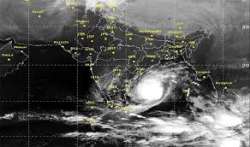
Several parts of north Tamil Nadu, including Chennai, and south Andhra Pradesh coast will receive heavy to very heavy rain starting Sunday evening due to a severe cyclonic storm – Vardah, Met officials said
Vardah is likely to make landfall on Monday evening, officials added.
''The cyclone is at present situated 480km east north-east off Chennai coast. It is likely to move south westward over the Bay of Bengal and cross north Tamil Nadu and South Andhra coast, mostly near Chennai, on Monday evening," a regional meteorological centre official said
"The wind speed is around 11km and it will intensify by today evening and later weaken and cross the coast by Monday evening," the official added.
The fishermen were asked not to venture into sea.
Meanwhile, Vardah is expected to cross the Bay of Bengal coast between Sriharikota and Krishnapatnam in Andhra Pradesh's SPS Nellore district after 5 PM on Monday, bringing with it high velocity winds of up to 100 kmph.
"The intensity of Vardah may not be as high as Hudhud, which battered Visakhapatnam in October 2014. Nevertheless, we are taking all precautions to minimise the damage, if any. We are taking the help of ISRO to track the cyclonic progression and accordingly we are taking all necessary emergency measures," Andhra Chief Minister N Chandrababu Naidu said.
"We have kept four teams of National Disaster Response Force ready,” he added.
(With agencies input)
Latest India News
